

Chicago weather: Rain moves in Monday with potential for damaging storms
Chicago weather: Rain moves in Monday with potential for damaging storms
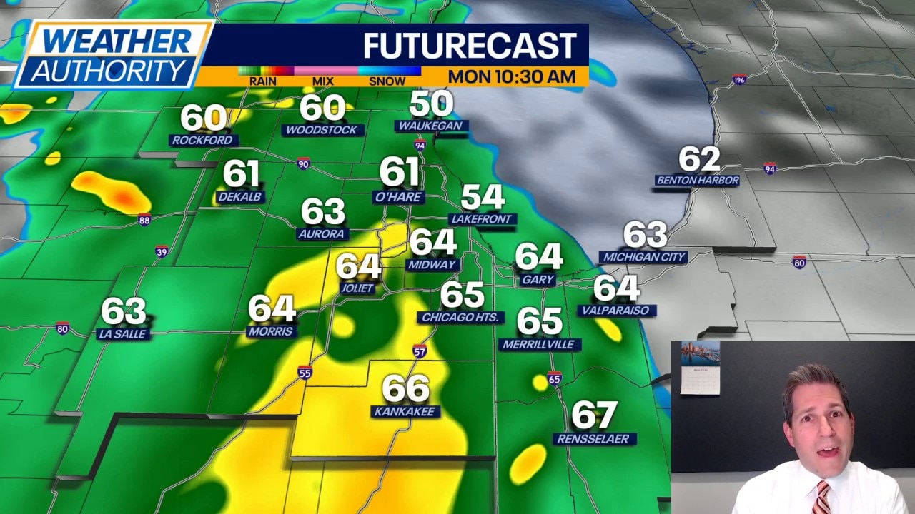
Fox Chicago's JD Rudd has the latest forecast.
CHICAGO - Things are quiet now but that may not be the case in about 24 hours.
Rain and storms look likely for Monday, along with a threat for severe weather by the evening. As it stands now, we may catch at least two rounds of rain. The first would be in the morning, lingering through the lunch hour. This would be general rain with a few pockets of thunderstorms possible. The threat of severe weather during this time period (9am to about 1pm) would be low.
The next round is expected to roll in from the west after about 6pm, but that activity hinges on a couple of morning variables: how fast does that first batch move out and, do we get any sunshine in the afternoon? The more sun we see and the drier we are in the afternoon, the higher chance we have of severe weather in the evening.
We could see storms that produce large hail, damaging wind gusts, and rotation Monday evening. Along with that, pockets of heavy rainfall are expected. This would impact those areas who are still dealing with high water and localized flooding.
Be prepared for sudden changes Monday night and have a way to get alerts if/when they are issued. The threat of severe weather should leave the area shortly after 11pm Monday.
Highs look to climb into the 70s for many spots, with the warmest air farther south and southwest. Once the system rolls through, cooler air works in and settles on top of us for a while.
Expect a cloudy sky with some sun on Tuesday; highs in the 60s. Another shower chance is possible Wednesday, otherwise cooler with highs in the 50s for many. We'll keep those 50s going through Friday before it gets a little bit warmer over the upcoming weekend. Dry conditions should prevail from Thursday through Sunday.