

Chicago weather: Warm day near 80 before evening storms move in
CHICAGO - It would be nice if one of these times where we get a warm up we aren’t also worried about thunderstorms. But unfortunately, that is the case once again today.
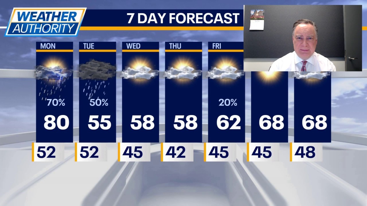
It won’t be breezy and temperatures will be flirting with 80 by late afternoon. There’s even a blowing dust advisory for areas generally south of I-80, but dirt from empty agricultural areas is possible area-wide.
Showers and storms are likely to develop very late in the day — perhaps around sunset and slide across our viewing area during the early evening. There are many reasons to argue against anything severe occurring in our viewing area, but there is still a very small chance for some hail or gusty straight-line winds.
What's next:
After the storms depart, it will turn cooler. In fact, Tuesday's high temperatures will likely be mired in the mid 50s for about a 25° drop from day to day. Light showers are possible tomorrow, especially over our southern viewing area.
Wednesday and Thursday we will dry out under partly cloudy skies with highs both days not far from 60 and overnight lows in the low 40s.
On Friday there’s a chance for showers with highs in the low 60s, but it does not appear to be an all-day rain.
Milder temperatures are expected over the weekend when highs will make it into the upper 60s both days with mostly to partly sunny skies.
The Source: The information in this forecast came from FOX Chicago's Mike Caplan.