Cooler pattern for Chicago could stick around
CHICAGO - It's been a rather warm summer so far that has been punctuated by a few days of extreme heat. Most of us experienced scorching heat on Tuesday as highs hit the middle 90s but the game changer was the humidity. The combination of the high heat and ample moisture in the air made it feel like 110 degrees or more for many spots south and southwest of the city. It felt like 100 degrees or more for the rest of the area.
O'Hare hit 94 degrees on a torrid Tuesday, the hottest day in about two weeks. June ended up nearly 2 degrees above average and July is now running nearly 3 degrees above average.
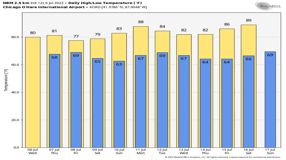
We are fast approaching what is climatologically the hottest stretch of summer. The average highs between July 11- 17 are 84.8 degrees. The long range forecasts are suggesting we won't see any of the scorching heat like we saw Tuesday through the next at least two weeks or so.
SUBSCRIBE TO THE FOX 32 YOUTUBE CHANNEL
The National Blend of Models has our highs falling back below average today and staying there through Sunday. Highs slip into the 70s for Friday and Saturday. We flirt with 90 degrees a few days in this extended forecast but nothing extreme to fear from this vantage point.
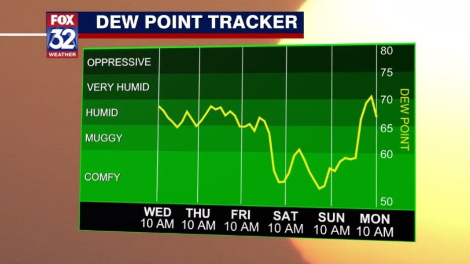
Relief from the high humidity is here today with more coming by the weekend.
We should drop from "humid" conditions to "comfy" conditions by late Friday. We stay mainly in the "comfy" category through the weekend according to our dew point tracker.
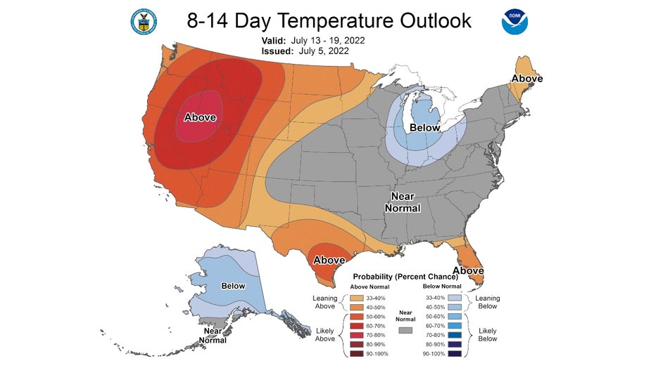
The Climate Prediction Center's 6-10 day and 8-14 day temperature outlooks corroborate the NBM's forecast.
The forecast for next Monday through Friday has us "near normal" for the period.
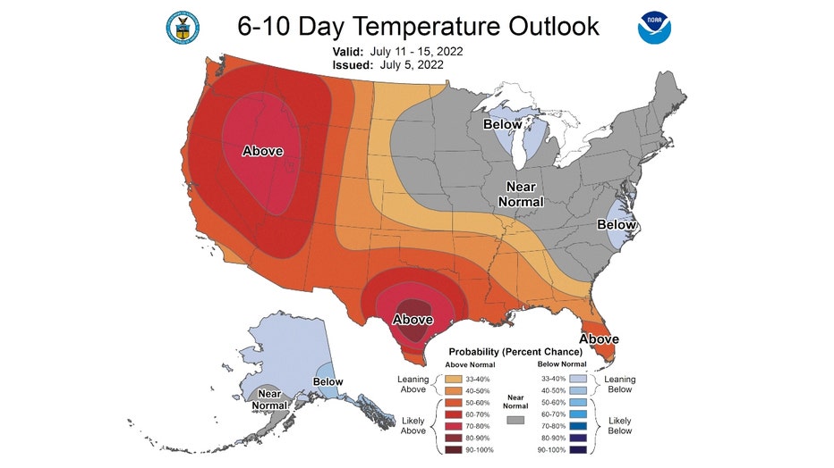
The longer range forecast for next Wednesday through the following Tuesday has us "leaning below" average overall.
This is the first forecast like this calling for cooler than average conditions so far this summer.