

Live updates: Severe weather threatens Chicagoland, tornadoes possible
CHICAGO - A Severe Thunderstorm Watch was issued Monday for most of the Chicago area and northwest Indiana as conditions are favorable for strong to severe storms through the afternoon.
The forecast:
According to the National Weather Service, the primary threats include wind gusts up to 70 mph, isolated hail up to ping pong ball size, and the possibility of tornadoes.
The watch will remain in effect until 5 p.m. CST.
The NWS estimates more than 13.9 million people are included in the watch area, along with more than 4,200 schools and 278 hospitals.
Live severe weather updates
- O'Hare International Airport has issued a ground stop due to thunderstorms until 12:45 p.m.
- A Severe Thunderstorm Warning has been issued for more areas in Lake County, Ind. until 12:15 p.m., according to the NWS.
- A Severe Thunderstorm Warning has been issued for Chicago, Cook and Lake County in Indiana until 11:30 a.m., according to the NWS. Winds gusted at Midway airport at 53 miles per hour.
- According to FOX Chicago meteorologist Michael Caplan, the storms appear to be weakening. The Severe Thunderstorm Watch issued for Kendall and Grundy Counties has been canceled.
- Ground stop issued for Midway International Airport due to thunderstorms until 11:45 a.m., according to the FAA.
- Ground delay issued at O’Hare Airport due to thunderstorms; arrivals are delayed an average of 76 minutes, while departures are delayed an average of 30 minutes and increasing.
- A Severe Thunderstorm Warning has been issued for Will, Grundy and Kendall counties until 11 a.m.
- A Severe Thunderstorm Watch has been issued for most of the Chicago area and northwest Indiana until 5 p.m.
What's next:
Tuesday may have a similar footprint of shower and thunderstorm activity with the bulk of it happening during the morning and/or early afternoon hours.
In fact, it is possible that much of the area will miss out on rainfall altogether tomorrow with a bias towards our southern counties.
Highs will once again be close to 80° ahead of the cold front that will sweep through late in the afternoon.
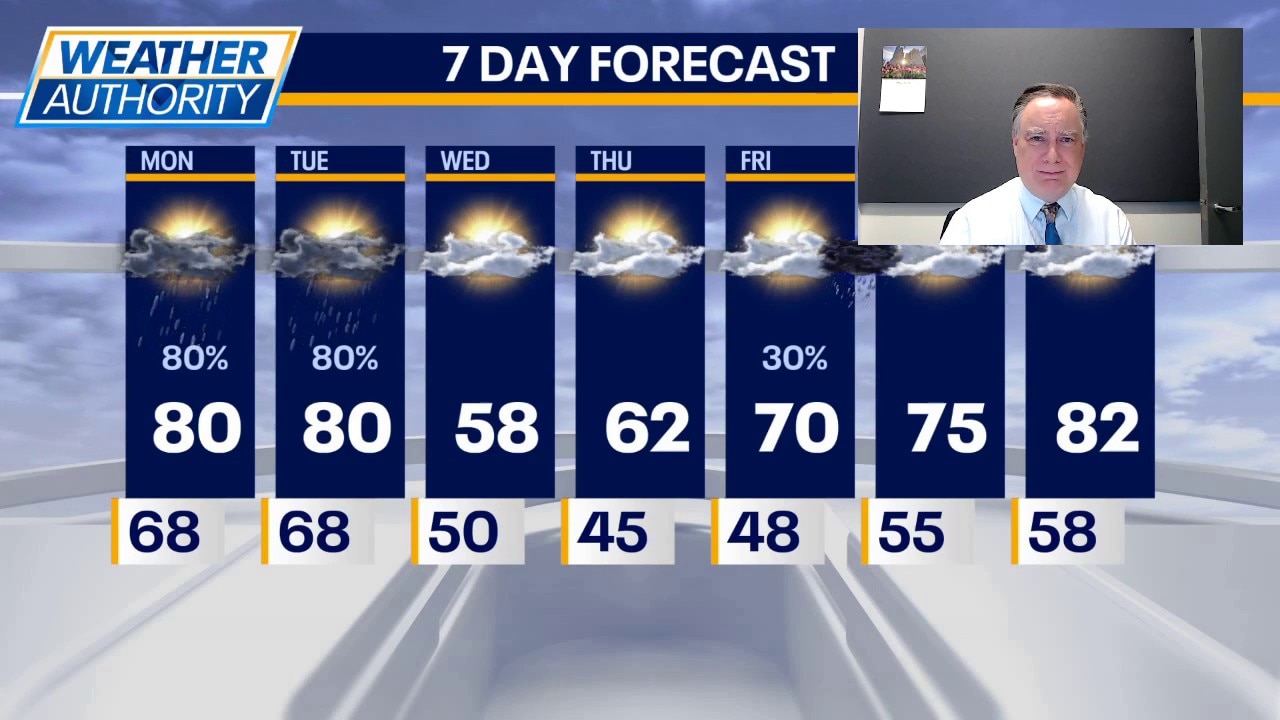
Sharp midweek cooldown in Chicago
Behind that front, we will have a couple of cooler days Wednesday and Thursday with highs on Wednesday struggling to hit 60, then barely in the 60s on Thursday. Both days will be cooler by the lake.
That trend will continue even as temperatures climb Friday, Saturday and Sunday. Highs on Friday will be close to 70 and then reach 80 by Sunday. The highest chance of any rainfall during those three days will be Friday night.
The Source: The information in this story came from the National Weather Service and FOX Chicago's Mike Caplan.