

Wintry weather arrives early in Chicago
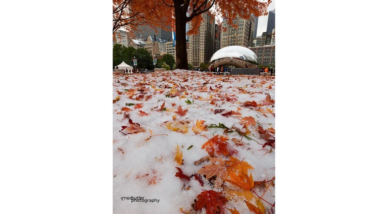
An early snow scene from November 10th, 2017 (https://www.barrybutlerphotography.com/)
Chicago - It's another case of weather whiplash. Highs will drop to December like levels this weekend after record highs in the 70s on Thursday. It seems likely the 76 degree record high at O'Hare will be the warmest temperature we see for several months. It will be a near 40 degree difference between Thursday's high and Saturday's high. There is even a little light snow in the forecast.
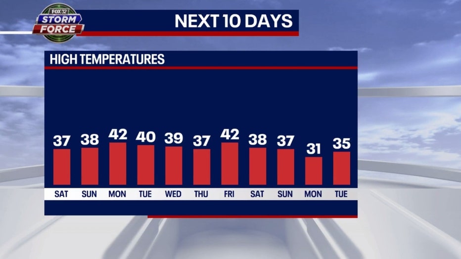
The warmest days of the next eleven would be Monday and the following Friday according to this model. Those highs will be between 5 to 10 degrees below average. The high of 31 forecast for a week from Monday will be 15 degrees below average.
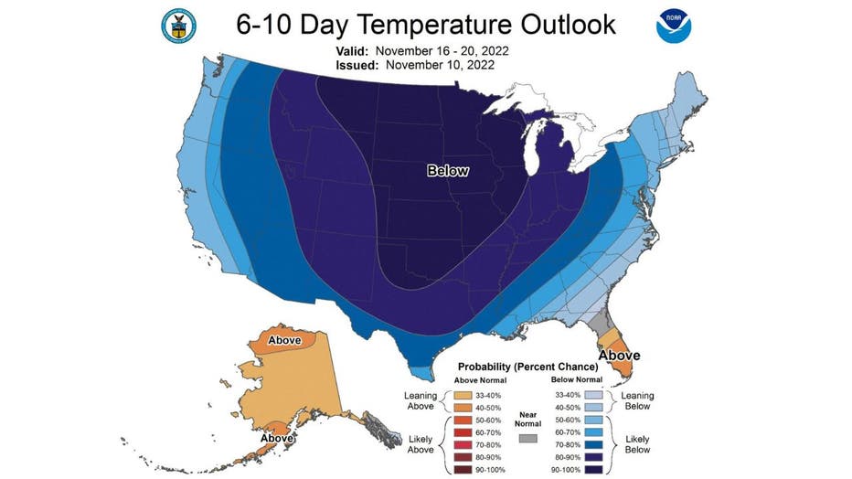
This cold pattern could continue well into November. The longer range forecasts from the Climate Prediction Center have the blues. Any shade of blue on these maps indicate an area that is favored for colder than average temperatures. The darker the blue, the more likely it will occur. Chicago is in the darkest shades of blue on both of the maps.
The 6-10 day temperature outlook has us "likely below" average from next Wednesday through the following Sunday.
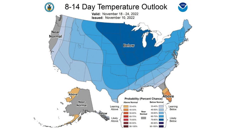
The 8-14 day temperature outlook also has us in the "likely below" average category. This covers the period from next Friday through the following Thursday.
To add insult to injury, we could see a few flurries fly early Saturday and a few snow showers later in the day. There is also a chance for some light snow on Tuesday. It is not out of the question on either one of those days we might get a dusting of snow in some grassy areas.