

Chicago weather: Warmer air returns with scattered storms possible this week
Warmer air returns to Chicagoland with scattered storms possible this week
Mike Caplan has your Chicago weather update!
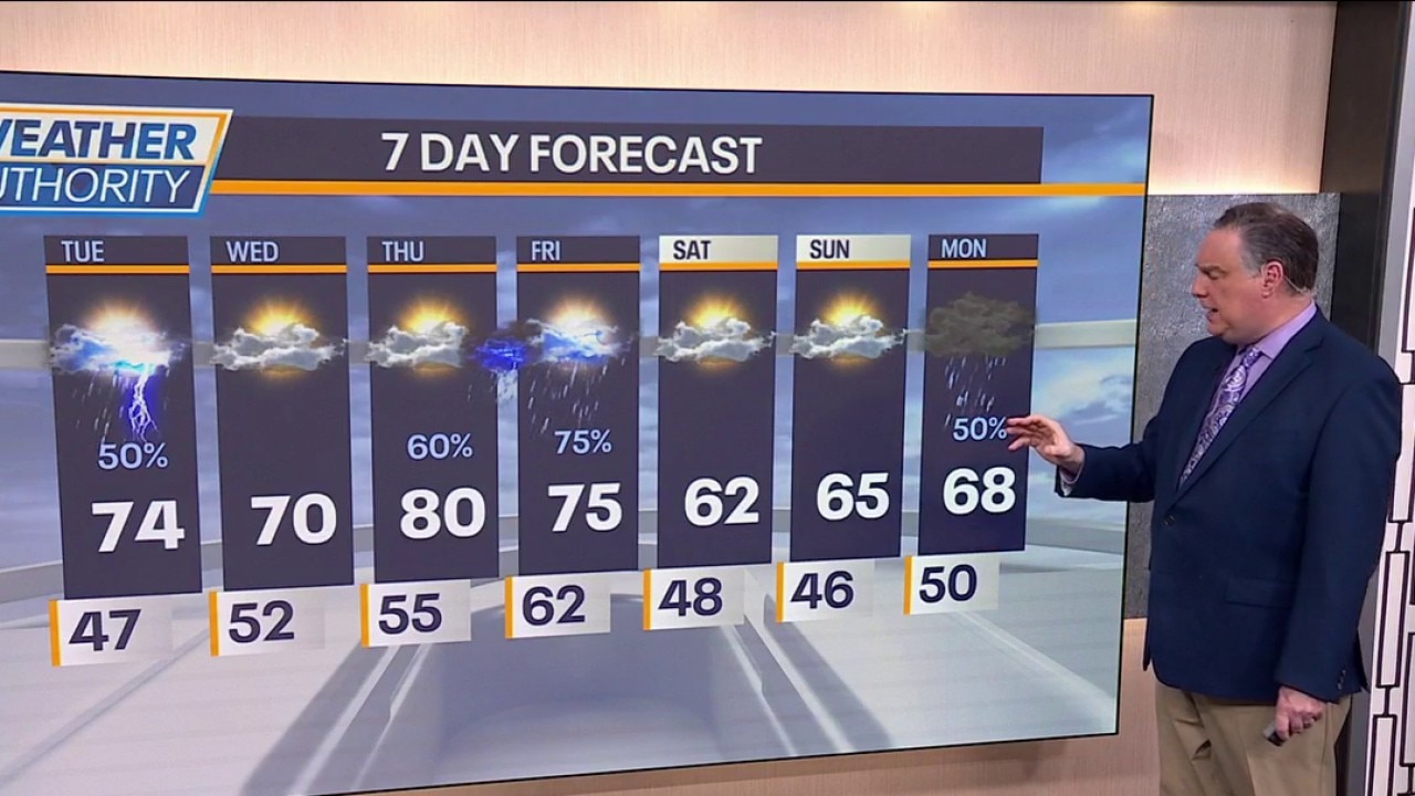
CHICAGO - Warmer air returns starting today, but there are some chances for showers and storms moving forward.
Highs should be in the low to mid 70s under partly sunny skies. Showers and a few thunderstorms will move through during the afternoon, but severe weather is not expected. The heaviest rainfall will likely fall south of where the river flooding is causing the greatest problems.
Showers will be gone by later tonight and temperatures will stay in the 50s. Wednesday won’t be quite as warm, but still mild with highs around 70. A wind off the lake will knock temperatures back into the 50s near shore.
What's next:
On Thursday, the next surge of warmth moves in with highs hitting 80°. Skies will become partly sunny in the afternoon and at night there’s a chance for showers and thunderstorms. Showers may continue into a portion of Friday as well with highs in the low 70s.
The weekend looks pleasant with highs both days in the low to mid 60s under partly to mostly sunny skies. The next chance of showers and possible thunder arrives on Monday.
The Source: The information in this forecast came from FOX Chicago's Mike Caplan.